


 THE SETTLEMENT OF LANARK COUNTY
WITH SPECIAL ATTENTION TO BATHURST TOWNSHIP*
In the Fall of 1815, settlement began in Lanark County. Earlier in the year the Earl of Bathurst, his Majesty’s Secretary of State
for the colonies, had issued a proclamation in England offering free passage, etc., to anyone who wished to become a settler in
Canada. Scottish Highlanders took up the offer that, besides free passage, included one hundred acres of land for each male
immigrant over legal age. Three hundred men, women, and children sailed from Greenock on the river Clyde on June 11, 1815. They
arrived in Quebec on September 4th only to find that the colonial authorities had made no preparation for their arrival. They proceeded
up the St. Lawrence to Brockville where they spent the winter and the next spring in temporary huts. Surveyors were hurriedly brought
in to survey a location for them.
The greater number of these Scottish immigrants settled on what is still known today as the Scotch Line. The Earl of Bathurst, under
whose patronage the “Scotch Colony” was formed and by whose influence at Court the Prince Regent’s sympathies were secured,
issued orders whereby these immigrants obtained not only free passage and land grants but also free rations from the British
Government for a year, and to each group of four families the necessary tools and implements with which to start ‘life in the bush’ – a
grindstone, a crosscut and a whip saw. Each family received an adze, handsaw, drawing knife, one shell augur, two gimlets, door-lock
and hinges, scythe and snath, reaping-hook, two hoes, hay fork, skillet camp kettle, and a blanket for each of its members.
Most of the families in the Scotch Colony lived in tents or bark huts during the summer and fall of 1816 until the cold weather forced
them to build log cabins. For quite a length of time there was one yoke of oxen in the County, and one cow in 1817. Most of the
supplies the settlers needed were carried in by them from the nearest settlements twenty miles south towards the St. Lawrence. In
considering the requirements of the settlers, the religious and educational needs were not forgotten. The teacher, John Halliday, came
in 1815 with the settlers, and the clergyman, The Rev. Bell, came in June, 1817. The first religious service he conducted was the first
ever in this locality.
The sale of lots had begun early in 1816. Twelve lots in Bathurst Township were sold to new settlers who belonged to the “Glengarry
Fencibles” on April 17th of that year and, in June, “The Military Colony of Perth” – British regulars whose terms of service had expired
in Canada, and those who had been members of the Canadian corps in the recent war with the United States – settled chiefly in
Bathurst and Drummond Townships. More Scottish settlers arrived in 1820.
The first town meetings were held in 1817, and people from Bathurst Township and Perth were elected to the Eighth Parliament of
Upper Canada in 1820.
Within the space of a very few years, most of the County was settled. From the census of 7,928 in 1825, the population grew to 15,198
in 1841, and to 31,369 in 1861. The census in 1871 recorded a dramatic loss of population to 23,020, contributed largely to the
exhaustion of the forests and consequent decline of the lumber trade. By 1880 the area of “occupied” land in the County totaled
490,452 acres of which 232,516 acres were improved, 145,784 under crop and 2,054 devoted to gardens and orchards, the whole
being in the possession of 3,599 occupiers, of whom 3,208 were owners of the land so occupied.
By 1880 the village of Fallbrook contained a hotel, store, grist mill, shingle mill, two carding mills, and an iron mine. Balderson’s
Corners contained hotels, two churches, a school, two general stores, a cheese factory, a pump factory, and several mechanics’
shops. In an actual 1863 survey map of Bathurst Township, owners of about 20 lots with waterfront property on Bennett and Fagan are
shown. Unfortunately, the names of these owners in the Atlas are unreadable.
Barbara Brush
*Information from “Historical Ontario Atlas of Lanark and Renfrew Counties – 1880 – 1881”, H. Belden and Co., Toronto
Map of the Counties of Lanark and Renfrew Counties published by D.P. Putnam, Prescott, Canada West in 1863 from actual surveys
under the direction of H.F. Walling.
Reprint Edition 1972 Printed by Richardson, Bond and Wright Ltd., Owen Sound, Ontario.
© Bennett & Fagon Lakes Association
LOT OWNERS ON NORTH SIDE OF BENNETT LAKE
Concession XI
Lot 16 – D. Warrington
Lot 15 – M. Murphy/J. Hughes
Lot 14 – J. Ennis/T. Campbell
Lot 13 – A. Ennis
Lot 12 – H. Warrington
Lot 9 - J. Erwin
Lot 8 - T. Erwin
Lot 7 - R. Gerry/W. Gerry
Lot 6 - R. Canill/P.Allan
Concession X (at lake)
Lot 13 – S. D_____?
Lot 12 – F. D______?
LOT OWNERS ON SOUTH SIDE OF BENNETT LAKE
Concession X (at lake)
Lot 16 – J. Morris
Lot 15 – M. Fisher
Lots 13 and 12 – F. Darow
Concession IX
Lot 16 – H. Bec/J. Freeman
Lot 15 – J. Furlong
Lot 14 – J. Hopkins
Lot 13 – R. Tovey
Lot 12 – W. McVeiagh
Lot 11 – W. McVeiagh
Lot 10 – A. Fudget
Lot 2 - W. Doran
Concession VIII (at lake)
Lot 8 - R. Bennett Sr./E. Bennett
Lot 6 - I. Wheeler/W. McLebhan
Lot 5 - J. Kirkham
LOT OWNERS ON NORTH SIDE OF FAGAN LAKE
Concession X
Lot 3 - M. Furgeson/W. Morris
Concession IX
Lot 1 - W. _______?
Next numbering of Lots to the west
Lot 22 - J. Jod
Lot 21 - A. Robismi
Lot 20 - I. Murphy
Lot 19 - K. Rontis
LOT OWNERS ON SOUTH SIDE OF FAGAN LAKE
Concession IX/VIII
Lot 22 - M. Fitzpatrick
Lot 21 - ?. Cilones
Lot 19 - A. Adams
Names of Lot Owners taken from copy of an old map (possibly
1863) purchased from the Lanark County Historical Society.
The printing of some names continued over the lake and were,
therefore, impossible to read. i.e. Concession X at Bennett Lake,
Lots 13 and 12.
Other names may not be spelled correctly.
THE SETTLEMENT OF LANARK COUNTY
WITH SPECIAL ATTENTION TO BATHURST TOWNSHIP*
In the Fall of 1815, settlement began in Lanark County. Earlier in the year the Earl of Bathurst, his Majesty’s Secretary of State
for the colonies, had issued a proclamation in England offering free passage, etc., to anyone who wished to become a settler in
Canada. Scottish Highlanders took up the offer that, besides free passage, included one hundred acres of land for each male
immigrant over legal age. Three hundred men, women, and children sailed from Greenock on the river Clyde on June 11, 1815. They
arrived in Quebec on September 4th only to find that the colonial authorities had made no preparation for their arrival. They proceeded
up the St. Lawrence to Brockville where they spent the winter and the next spring in temporary huts. Surveyors were hurriedly brought
in to survey a location for them.
The greater number of these Scottish immigrants settled on what is still known today as the Scotch Line. The Earl of Bathurst, under
whose patronage the “Scotch Colony” was formed and by whose influence at Court the Prince Regent’s sympathies were secured,
issued orders whereby these immigrants obtained not only free passage and land grants but also free rations from the British
Government for a year, and to each group of four families the necessary tools and implements with which to start ‘life in the bush’ – a
grindstone, a crosscut and a whip saw. Each family received an adze, handsaw, drawing knife, one shell augur, two gimlets, door-lock
and hinges, scythe and snath, reaping-hook, two hoes, hay fork, skillet camp kettle, and a blanket for each of its members.
Most of the families in the Scotch Colony lived in tents or bark huts during the summer and fall of 1816 until the cold weather forced
them to build log cabins. For quite a length of time there was one yoke of oxen in the County, and one cow in 1817. Most of the
supplies the settlers needed were carried in by them from the nearest settlements twenty miles south towards the St. Lawrence. In
considering the requirements of the settlers, the religious and educational needs were not forgotten. The teacher, John Halliday, came
in 1815 with the settlers, and the clergyman, The Rev. Bell, came in June, 1817. The first religious service he conducted was the first
ever in this locality.
The sale of lots had begun early in 1816. Twelve lots in Bathurst Township were sold to new settlers who belonged to the “Glengarry
Fencibles” on April 17th of that year and, in June, “The Military Colony of Perth” – British regulars whose terms of service had expired
in Canada, and those who had been members of the Canadian corps in the recent war with the United States – settled chiefly in
Bathurst and Drummond Townships. More Scottish settlers arrived in 1820.
The first town meetings were held in 1817, and people from Bathurst Township and Perth were elected to the Eighth Parliament of
Upper Canada in 1820.
Within the space of a very few years, most of the County was settled. From the census of 7,928 in 1825, the population grew to 15,198
in 1841, and to 31,369 in 1861. The census in 1871 recorded a dramatic loss of population to 23,020, contributed largely to the
exhaustion of the forests and consequent decline of the lumber trade. By 1880 the area of “occupied” land in the County totaled
490,452 acres of which 232,516 acres were improved, 145,784 under crop and 2,054 devoted to gardens and orchards, the whole
being in the possession of 3,599 occupiers, of whom 3,208 were owners of the land so occupied.
By 1880 the village of Fallbrook contained a hotel, store, grist mill, shingle mill, two carding mills, and an iron mine. Balderson’s
Corners contained hotels, two churches, a school, two general stores, a cheese factory, a pump factory, and several mechanics’
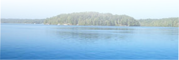
shops. In an actual 1863 survey map of Bathurst Township, owners of about 20 lots with waterfront property on Bennett and Fagan are
shown. Unfortunately, the names of these owners in the Atlas are unreadable.
Barbara Brush
*Information from “Historical Ontario Atlas of Lanark and Renfrew Counties – 1880 – 1881”, H. Belden and Co., Toronto
Map of the Counties of Lanark and Renfrew Counties published by D.P. Putnam, Prescott, Canada West in 1863 from actual surveys
under the direction of H.F. Walling.
Reprint Edition 1972 Printed by Richardson, Bond and Wright Ltd., Owen Sound, Ontario.
© Bennett & Fagon Lakes Association
LOT OWNERS ON NORTH SIDE OF BENNETT LAKE
Concession XI
Lot 16 – D. Warrington
Lot 15 – M. Murphy/J. Hughes
Lot 14 – J. Ennis/T. Campbell
Lot 13 – A. Ennis
Lot 12 – H. Warrington
Lot 9 - J. Erwin
Lot 8 - T. Erwin
Lot 7 - R. Gerry/W. Gerry
Lot 6 - R. Canill/P.Allan
Concession X (at lake)
Lot 13 – S. D_____?
Lot 12 – F. D______?
LOT OWNERS ON SOUTH SIDE OF BENNETT LAKE
Concession X (at lake)
Lot 16 – J. Morris
Lot 15 – M. Fisher
Lots 13 and 12 – F. Darow
Concession IX
Lot 16 – H. Bec/J. Freeman
Lot 15 – J. Furlong
Lot 14 – J. Hopkins
Lot 13 – R. Tovey
Lot 12 – W. McVeiagh
Lot 11 – W. McVeiagh
Lot 10 – A. Fudget
Lot 2 - W. Doran
Concession VIII (at lake)
Lot 8 - R. Bennett Sr./E. Bennett
Lot 6 - I. Wheeler/W. McLebhan
Lot 5 - J. Kirkham
LOT OWNERS ON NORTH SIDE OF FAGAN LAKE
Concession X
Lot 3 - M. Furgeson/W. Morris
Concession IX
Lot 1 - W. _______?
Next numbering of Lots to the west
Lot 22 - J. Jod
Lot 21 - A. Robismi
Lot 20 - I. Murphy
Lot 19 - K. Rontis
LOT OWNERS ON SOUTH SIDE OF FAGAN LAKE
Concession IX/VIII
Lot 22 - M. Fitzpatrick
Lot 21 - ?. Cilones
Lot 19 - A. Adams
Names of Lot Owners taken from copy of an old map (possibly
1863) purchased from the Lanark County Historical Society.
The printing of some names continued over the lake and were,
therefore, impossible to read. i.e. Concession X at Bennett Lake,
Lots 13 and 12.
Other names may not be spelled correctly.

 © Bennett & Fagon Lakes Association
LOT OWNERS ON NORTH SIDE OF BENNETT LAKE
Concession XI
Lot 16 – D. Warrington
Lot 15 – M. Murphy/J. Hughes
Lot 14 – J. Ennis/T. Campbell
Lot 13 – A. Ennis
Lot 12 – H. Warrington
Lot 9 - J. Erwin
Lot 8 - T. Erwin
Lot 7 - R. Gerry/W. Gerry
Lot 6 - R. Canill/P.Allan
Concession X (at lake)
Lot 13 – S. D_____?
Lot 12 – F. D______?
LOT OWNERS ON SOUTH SIDE OF BENNETT LAKE
Concession X (at lake)
Lot 16 – J. Morris
Lot 15 – M. Fisher
Lots 13 and 12 – F. Darow
Concession IX
Lot 16 – H. Bec/J. Freeman
Lot 15 – J. Furlong
Lot 14 – J. Hopkins
Lot 13 – R. Tovey
Lot 12 – W. McVeiagh
Lot 11 – W. McVeiagh
Lot 10 – A. Fudget
Lot 2 - W. Doran
Concession VIII (at lake)
Lot 8 - R. Bennett Sr./E. Bennett
Lot 6 - I. Wheeler/W. McLebhan
Lot 5 - J. Kirkham
LOT OWNERS ON NORTH SIDE OF FAGAN LAKE
Concession X
Lot 3 - M. Furgeson/W. Morris
Concession IX
Lot 1 - W. _______?
Next numbering of Lots to the west
Lot 22 - J. Jod
Lot 21 - A. Robismi
Lot 20 - I. Murphy
Lot 19 - K. Rontis
LOT OWNERS ON SOUTH SIDE OF FAGAN LAKE
Concession IX/VIII
Lot 22 - M. Fitzpatrick
Lot 21 - ?. Cilones
Lot 19 - A. Adams
Names of Lot Owners taken from copy of an old map (possibly
1863) purchased from the Lanark County Historical Society.
The printing of some names continued over the lake and were,
therefore, impossible to read. i.e. Concession X at Bennett Lake,
Lots 13 and 12.
Other names may not be spelled correctly.
© Bennett & Fagon Lakes Association
LOT OWNERS ON NORTH SIDE OF BENNETT LAKE
Concession XI
Lot 16 – D. Warrington
Lot 15 – M. Murphy/J. Hughes
Lot 14 – J. Ennis/T. Campbell
Lot 13 – A. Ennis
Lot 12 – H. Warrington
Lot 9 - J. Erwin
Lot 8 - T. Erwin
Lot 7 - R. Gerry/W. Gerry
Lot 6 - R. Canill/P.Allan
Concession X (at lake)
Lot 13 – S. D_____?
Lot 12 – F. D______?
LOT OWNERS ON SOUTH SIDE OF BENNETT LAKE
Concession X (at lake)
Lot 16 – J. Morris
Lot 15 – M. Fisher
Lots 13 and 12 – F. Darow
Concession IX
Lot 16 – H. Bec/J. Freeman
Lot 15 – J. Furlong
Lot 14 – J. Hopkins
Lot 13 – R. Tovey
Lot 12 – W. McVeiagh
Lot 11 – W. McVeiagh
Lot 10 – A. Fudget
Lot 2 - W. Doran
Concession VIII (at lake)
Lot 8 - R. Bennett Sr./E. Bennett
Lot 6 - I. Wheeler/W. McLebhan
Lot 5 - J. Kirkham
LOT OWNERS ON NORTH SIDE OF FAGAN LAKE
Concession X
Lot 3 - M. Furgeson/W. Morris
Concession IX
Lot 1 - W. _______?
Next numbering of Lots to the west
Lot 22 - J. Jod
Lot 21 - A. Robismi
Lot 20 - I. Murphy
Lot 19 - K. Rontis
LOT OWNERS ON SOUTH SIDE OF FAGAN LAKE
Concession IX/VIII
Lot 22 - M. Fitzpatrick
Lot 21 - ?. Cilones
Lot 19 - A. Adams
Names of Lot Owners taken from copy of an old map (possibly
1863) purchased from the Lanark County Historical Society.
The printing of some names continued over the lake and were,
therefore, impossible to read. i.e. Concession X at Bennett Lake,
Lots 13 and 12.
Other names may not be spelled correctly.